Overview
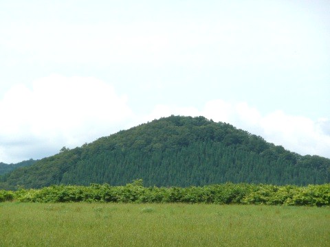
Mount Hiromori (Hiromori-yama) is a 639.4-meter peak in Kazuno City, Akita Prefecture. Set in the northeastern part of the prefecture, close to the border with Aomori, it forms one corner of the Kazuno hills and is known as a quiet, green-wrapped mountain. It is not a peak with famous, heavily developed trails, but that is exactly its appeal: in nature with few other visitors, you can savor the open, satoyama-like scenery typical of the Kazuno countryside. Rather than spectacle, it suits those who come seeking stillness and mountain air.
Highlights
- ●A gentle, satoyama-style summit rising to 639.4 meters
- ●The lush hill country of the northeast, near the Aomori border
- ●The air of nature wrapped in stillness, with few other people
- ●Seasonal scenery from early-summer greenery to autumn color
History
Mount Hiromori is one of the satoyama hills of Kazuno City, carrying the marks of a landscape long shaped alongside local life. Kazuno has a long history as a center of mining and transport, and hills like this are part of that regional character. Detailed records of the mountain's own origins and any tradition of climbing are limited, so it is best to consult Kazuno City or official sources for specifics.
Access
The mountain lies in Kazuno City, around 40.4 degrees north and 140.9 degrees east. It sits in the northeastern part of the prefecture, in the hill country reached inland from central Kazuno. The state of trailheads, roads, and parking depends on current maintenance, so always check the latest official information and local guidance before entering the mountain.
Best season
From early summer, when the fresh greenery is dazzling, through autumn, when the slopes take on color, is the best season for hiking. Although the peak stands at about 639 meters, the hill country of northern Akita sees heavy winter snow, so the cold season demands proper equipment and experience. Check the weather and trail conditions for your chosen dates in advance.
Map
40.3966, 140.9236 · Wikidata
Suggested itinerary
- 1Head from central Kazuno to the foot of Mount Hiromori
- 2Advance slowly while taking in the green of the hills
- 3Look out over the surrounding ranges from an open viewpoint
- 4After descending, ease your tiredness with Kazuno's hot springs or local fare
Did you know?
💡 Its recorded elevation is 639.4 meters, an approachable height among the Kazuno hills. Being far from a flashy tourist site, it stands as something of a hidden gem for those who seek quiet nature.
Nearby spots
Traveler reviews0
No reviews yet. Be the first to share!